EMESENT HOVERMAP ST-X
The Next Generation In Autonomous LiDAR Mapping Technology

INTRODUCING THE EMESENT HOVERMAP ST-X
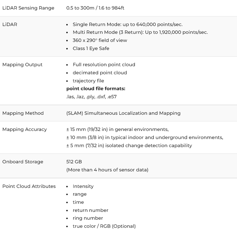
Hovermap ST-X incorporates the latest in LiDAR sensing technology to offer high density point clouds with increased coverage. Featuring a sensing range of 300 meters and more than a million points per second, it captures detailed, accurate data over a greater area in less time – giving you faster time to insight.
Hovermap ST-X also excels at indoor or close-range scans, producing sub-centimeter results thanks to the award-winning Wildcat SLAM solution, Automated Ground Control Points, and improved LiDAR sensor accuracy.
Uniquely versatile, Hovermap ST-X allows you to capture data in any environment. Mount it to a drone for autonomous aerial mapping, even in GPS-denied environments. Easily remove it from the drone and use it as a handheld, backpack, or vehicle-mounted scanner. Use a combination of these to rapidly capture as-builts and digital twins in minutes rather than hours.
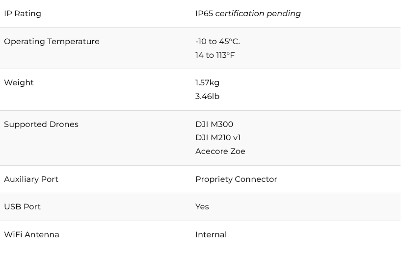
The tough, lightweight, and weather sealed design makes Hovermap ST-X equally capable in the harshest environments, above ground or underground, indoors or out.
Wondering how the Hovermap ST-X can streamline your mapping workflows? Contact us below!
[animated-words-rotator id=”1″]


EMESENT HOVERMAP ST-X FEATURES

CAPTURE DETAILED, ACCURATE DATA
A LiDAR sensing range of 300 meters and triple returns that captures more than one million points per second allows you to capture detailed, accurate data over a great area in less time – giving you faster time to insight.
SUB-CENTIMETER INDOOR SCANS
The award-winning Wildcat SLAM solution, Automated Ground Control Points (optional), and improved LiDAR sensor accuracy provides a cleaner, more precise point cloud with 4 to 5 mm accuracy allowing you to obtain more accurate measurements and improved insights.

UNIQUELY VERSATILE
The plug and play design and quick-release mechanism allow easy switching between modes. Use Hovermap as a handheld scanner; attached to a drone, vehicle, or pole; lowered in a cage; or mounted to a backpack to easily collect data anywhere. The compact, lightweight design makes it easy to carry and provides longer flight time.

ROBUST, AUTONOMOUS CAPABILITY
Advanced autonomy and 360 degree Collision Avoidance enables flight and mapping in challenging surroundings, including beyond visual line of sight and communication range, even in GPS-denied environments – providing new, valuable insights while the operator remains in a safe location.
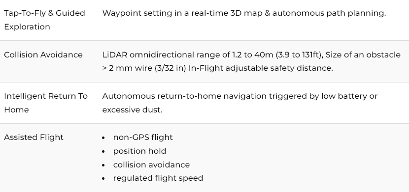
AUTONOMOUS TAP-TO-FLY
With Autonomous Waypoint Mode (AL2), pilots can fly an entire mission, from takeoff to landing, using a tablet.
Hovermap ST-X’s Tap-to-Fly feature enables exploration in previously inaccessible areas beyond line of sight and communication range, accessing unprecedented insights. The omnidirectional Collision Avoidance, Guided Exploration, and smart Return-to-Home functions ensure assets are kept safe and valuable equipment doesn’t get damaged or lost.
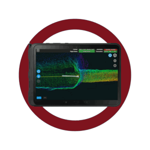
Hovermap ST-X streams a live point cloud to the Hovermap app, providing a real-time preview of the data as it is captured when in communication range. Allowing you to leave the site confident you’ve captured everything you need.

AUTONOMY LEVEL 0
Mapping Mode
Mapping Mode offers fast, accurate, and high resolution mobile scanning of environments where drone autonomy is unnecessary. Hovermap ST-X’s quick-release mechanism allows you to easily switch from a drone to handheld scanning or a backpack-, vehicle-, or protective shaft scanning cage-mount for SLAM-based mobile mapping.
AUTONOMY LEVEL 1
Pilot Assist Mode
Pilot Assist Mode provides omnidirectional Collision Avoidance, line of sight GPS-denied flight capability, and stability control, providing the confidence and stability for close, thorough inspections. It acts as a safety bubble for your drone, keeping the asset and your equipment safe.
AUTONOMY LEVEL 2
Autonomous Waypoints
Autonomous Waypoint Mode provides beyond line of sight flight through Smart Waypoints and Guided Exploration. Simply tap on the map to set smart waypoints, and Hovermap ST-X takes care of the rest, navigating to the waypoints, mapping the area, and keeping itself and the drone safe from obstacles.